a number of different routes are planned:
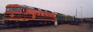
Work completed is: Tailem Bend to various destinations in Adelaide, dependant upon the era represented;
The Tailem Bend to Adelaide destinations (including the freight terminal built by AN at Regency Park - which was then given to NR by the Australian government in 1993) is now complete, subject to any minor mistakes.
The files may be downloaded from here. The associated return routes to Tailem Bend from Adelaide are included in the same zip file.
Click here to view a map of the route in construction, and here to see a gradient profile. They are both 640x320 pixels, the size of a DOS screen, and they can be viewed in a seperate window. Work in progress is: Port Augusta - Pichi-Richi Pass - Quorn
Route information received from the Pichi Richi Railway Preservation Society has permitted the creation of a beta test version of this route. Comments received so far suggest that driving the simulator you can recognise where you are. Thank you to the beta testers of the P.R.R.P.S.
A final "beta" route file may be downloaded from here. Your feedback is welcomed.
It seems likely that now the Pichi Richi Society's tracklaying into Port Augusta is completed that we may be able to finalise this set of track files. Their route actually goes under the Leigh creek line at the triangle apex at Stirling North! The RailSim line as constructed is how the track would have been originally. We may put in the deviation at a later date.
It is then hoped to be able to continue constructing the simulator line on to Hawker and on through Hookina down on to the western plains of the Flinders' Ranges. We have scouts out looking for the information. Maybe we shall be able to run Leigh Creek coal trains and the Marree Mixed and Ghan through the pass again. That would be nice. The P.R.R.P.S. is seeing if it can find anyone with gradient diagrams and maps to loan me.
Adelaide - Hallett's Cove - Willunga
The route Adelaide - Willunga and Mile End - Willunga (in both directions) has been completely constructed, and will be released shortly, as the companion routes from Adelaide through Hallett Cove to Port Stanvac and Noarlunga Centre have been completed. If you would like to pre-beta test this route, please email or phone me.
The Port Stanvac route will be that of the old oil train, fuel from the refinery to Birkenhead, and empties back. This is available in both dual track from Brighton to Stanvac, and the earlier single track version with no passenger stations from where the line diverged just before the old Hallet Cove station (on the top of the hill heading east). The Stanvac-Birkenhead line has been completed in both directions, in both versions.
The Noarlunga Centre passenger line has also been completed in both directions. These routes will shortly be available as a beta file for evaluation.
A possible development may well be the never constructed extension southwards from Noarlunga Centre to Seaford! Watch this space. Adelaide - Penfield Loop - Adelaide
The line created is in its original format, and the loop length is longer than prototypical due to the minimum radius constraints of RailSim.
The route is constructed and a beta test file will shortly be available. Adelaide - Outer Harbour Loop - Adelaide
The line created is in its original format, and the loop length is longer than prototypical due to the minimum radius constraints of RailSim.
The route is constructed and a beta test file will shortly be available. Adelaide - Port Adelaide (Dock Station)
Port Dock Station is where what was the Mile End Railway Museum relocated some years ago.
The route is constructed and a beta test file will shortly be available. Adelaide (or Mile End Goods) - North Gawler
Route information for the above was adapted from a RailSim route created some years ago by another author.
A final "beta" route file may be downloaded from here. Your feedback is welcomed.
Adelaide (or Mile End Goods) - Nuriootpa, Truro, and Angaston A final "beta" route file may be downloaded from here. Again, your feedback is welcomed.
The runs from Adelaide and Mile End Goods to the Barossa destinations are all the right length.
These several routes were digitised in a hurry from a set of 1:50,000 survey maps lent to me for three days only because of their being needed for the owner's work. A huge 'thank-you' to Richard Atkinson for the loan! We now have material on hand to construct the Narrow-Gauge SAR route Terowie - Peterborough - Quorn and the Broad Gauge Route Adelaide - Terowie to allow pre-war "Trans-Australian" connections to be made between Adelaide and Port Augusta, albeit with 50s and 60s diesel-electric locomotives. Also the Broken Hill to Port Pirie silver concentrates ore trains.
What would be nice would be to have technical information on the steam engines which plied these three routes, so that we can create them as RailSim locomotive files.
The webmaster would like to acknowledge how fortunate we are to have obtained a complete set of South Australian Railways gradient profiles. This has been made possible through the enthusiastic support of a senior officer of Trans-Adelaide, who has provided me with access to the old "Blue Book" of the SAR CME's department.
Also the South Australian Lands Department survey maps are mostly based on 1970s surveys, so we should be able to construct a reasonable approximation to any South Australian routes. These were used to construct the Barossa line mentioned elsewhere on this page.
Unfortunately, the CR archives, which became ANR in 1975, and then AN in 1982, were privatised in 1998 and because there are now quite large costs with obtaining any railway route information from official sources in South Australia, they are totally prohibitive to a retired person doing this work "for love". That is to say, unless someone has material they are prepared to lend. If that is you, please drop me a line by email or to PO Box 754, Modbury, South Australia 5092
Work in progress, but halted: Adelaide - Mount Barker Junction - Victor Harbour Adelaide - Balhannah - Mount Pleasant
Although work on the last three is currently halted, the above routes are in quite an advanced stage of construction, thanks to the help provided by members of the Port Dock Museum, SteamRanger, and Trans-Adelaide Rail.
Planned Routes:
Melbourne - Bacchus Marsh - Ballaraat (VR Broad gauge),
Interestingly, we actually have sufficient information to provide you with the entire Spencer Street or Dynon (Melbourne) to Dry Creek (Adelaide) route in several subdivisions, each not exceeding 160km (100 miles) in length. Watch this space! This route information has been received in part from both VicTrack and Great Northern, and while we have permission to proceed, we shall need to become "stabled in the refuge siding" for a while while other stuff gets done first.
Future Routes:
Perth - Midland Junction - Chidlow - Wundowie - Northam (WAGR narrow gauge Eastern main line)
Perth - Avon Valley - Northam (WAGR/Westrail standardisation)
Also about a year ago, three people associated with the Australian Railway Historical Society (West Australian Division) were located with great difficulty by telephone 1000 miles from where I live but they did not show any encouragement towards this project at all.
So, if the WA part of this project proceeds, it will probably be less than accurate, which is a great pity, unless someone reads this request for help and loans me some maps and charts! Sydney - Blue Mountains - Lithgow (NSWGR/PTC/SRA all eras)
Cab Ride
It obviously will have to be a series of still captures with a commentary, but we have put together a short trip to give you an idea. Click here and a new window will open. Every route so far constructed, and those which are currently planned, are those with some driving 'challenge'. Nobody is likely to want to drive 100 miles (160 kilometres) along an absolutely flat straight track!
Each is as accurately portrayed as possible for specified eras of operation, as some details may vary according to the year represented; for example the main south line out of Adelaide was reduced from dual to single track between Goodwood and Belair because of gauge standardisation in 1995. As mentioned elsewhere, don't expect the simulation to be video quality.
Support the Historical and Museum organisations
This author will not be taking a commission; as apart from personal interest, the whole project is really to assist the museums to raise additional income.
It may also become possible to test-drive in some museum locations, but expect to have to pay a small fee. While the program uses a standard computer keyboard for commands, a simple box with controls laid out like a locomotive's controls is being developed. Please check the Control Stand project on this site.
Details and links to the museum websites will be placed on here in due course.
If you download from here, it would be appreciated if you send a donation to the rail museum or preservation society of your choice. If you are involved with one that isn't listed, please let me know and I'll add the details here.
Thank you for working your way through these pages; the next one is the "Downloads" page, and is the last one.
|